Explore Maine Public Lands
Vast tracts of remote wilderness scattered across Maine
Story & Photos By Aislinn Sarnacki
Pine, spruce, and fir trees tower overhead, their trunks decorated with climbing moss and curling lichen. Their needle-covered branches shadow the forest floor, where vibrant mushrooms and ghostly flowers have popped up between twisting tree roots and hunks of granite.
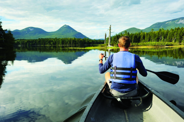
Welcome to Donnell Pond Public Land, a 14,000-acre chunk of wilderness in Down East, Maine. This enchanting forest — home to several mountains and remote ponds — is a paradise for hikers and paddlers. You can also camp there, if you don’t mind sleeping in a tent and using an outhouse.
Similar to state parks, public lands are owned and managed by the Maine Bureau of Parks and Land. But they tend to be a bit more rugged and remote than state parks. They’re also quite large, ranging from 500 to 43,000-plus acres.
If you’re looking for an adventure, visiting a public land unit is a great option. Just don’t expect many amenities. The trails are well-maintained and the wildlife habitats are well-protected, but you won’t find any ranger station, lifeguard, or playground on a public land unit. Instead, you’ll find the wilderness in all its glory.
Dogs are permitted, and access to public lands is usually free. However, in a few instances — such as inside the North Maine Woods — public lands are managed in cooperation with neighboring landowners and fees are collected. Phone service is often unreliable. So travel prepared, with survival and navigational tools.
A brochure produced by the Maine Bureau of Parks and Lands highlights 37 different public land units, covering more than half million acres. Each unit carters to a plethora of outdoor activities. Want to ride an ATV or snowmobile? Check out Salmon Brook Lake Bog Public Land in Aroostook County. Big into fishing? Visit Seboomook Lake Public Land in Piscataquis County.
Here are a few more public land units to enjoy.
Donnell Pond Public Lands
This public land unit of remote forest is located in Hancock County, between Franklin and Cherryfield. It’s home to several peaks with hiking trails, including Schoodic Mountain, Black Mountain, Caribou Mountain, and Tunk Mountain. In addition, paddling, fishing, and primitive camping can be enjoyed on Tunk Lake, Donnell Pond, Spring River Lake, and a few small, remote ponds.
On Donnell Pond, Schoodic Beach is a sandy, freshwater beach where you can swim and camp. It’s accessible by a 0.5-mile trail or by boat, and is one of the most popular spots on the property.
If you’re looking for a more private camping experience, the property features a few campsites that are accessible only by boat. First come, first serve.
Directions: Multiple parking areas provide access to various parts of Donnell Pond Public Lands. Access to Schoodic Beach, Schoodic Mountain, and Black Mountain is found on the gravel Schoodic Beach Road off Route 183 in Sullivan. Access to Caribou Mountain, Tunk Mountain, Spring River Lake, and Tunk Lake is off Route 182 just west of Cherryfield. Each have their own parking area.
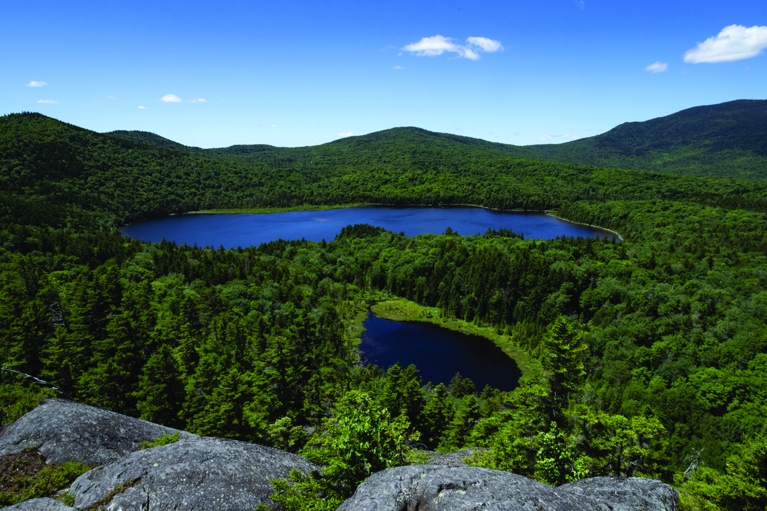
Deboullie Public Lands
The state acquired the 21,871-acre land unit in separate parcels over the course of 10 years, starting in 1975. Just 30 miles from the Canadian border, the land features small mountains and pristine trout ponds.
The name Deboullie is an adaptation of the French word “debouler,” which means tumble down. This refers to the impressive rock fields you can find on the property. You can hike right over one of these rock fields on a trail that leads up Deboullie Mountain.
Explore the property on 30 miles of hiking trails, where you’ll find unusual features such as small ice caves and a former (rebuilt) fire tower atop Deboullie Mountain that offers a panoramic view of the region. And if you’d like to visit for multiple days, then grab one of the 30 private campsites scattered throughout the property, some of which stand on the shores of lovely ponds. A group campsite is also available.
Directions: Reaching this property requires driving on gravel logging roads. From the south, take Route 11 north from Ashland to Portage, then turn left onto West Road (before Portage Lake). Drive 1 mile, then turn left onto Fish Lake Road-Rocky Brook Road. After about 4 miles, stop at the Fish River checkpoint to pay a fee. Drive 2 more miles, then turn right onto Hewes Brook Road. Follow that about 12.5 miles to T15 R9 Road-Red River Road, then 7 miles to Deboullie Public Lands.
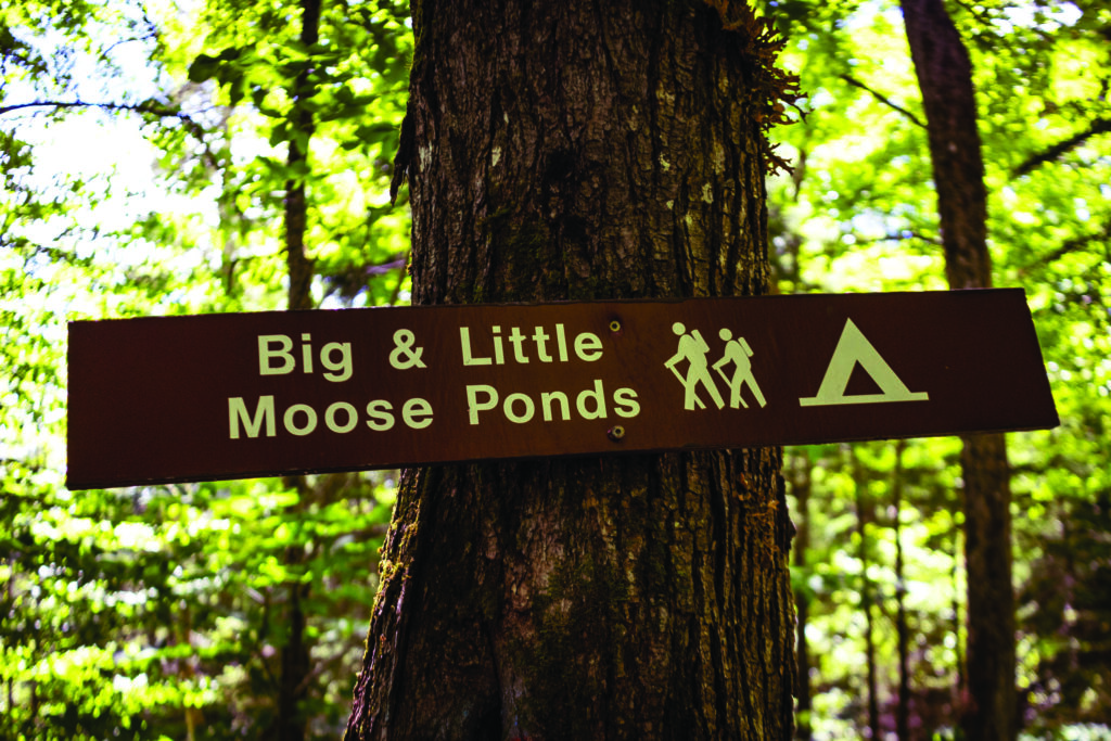
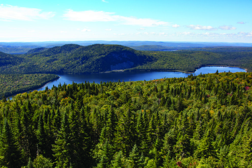
Little Moose Public Land
This 15,000-acre chunk of property near the shore of Moosehead Lake encompasses the impressive ridge of Big Moose and Little Moose mountains. Hiking trails explore both mountains, plus lead to six remote ponds where you can find backcountry tent sites.
ATVing is also popular there, and miles of single-track mountain biking trails are currently being developed throughout the property as well.
Not too far from downtown Greenville, this property is easily accessible year round (though some of the inner roads close during the winter, so some trailheads are hard to reach without a snowmobile). This is a great option for someone who is looking for a backcountry adventure but doesn’t want to travel too far away from civilization.
Directions: At the light in downtown Greenville, turn onto Route 15-Route 6 (Pritham Avenue) toward Rockwood (the west side of Moosehead Lake). Drive for about 5 miles, then turn left onto North Road. Several small parking lots for various trailheads are located along this gravel road.
(Courtesy of Aislinn Sarnacki)
(Courtesy of Aislinn Sarnacki)
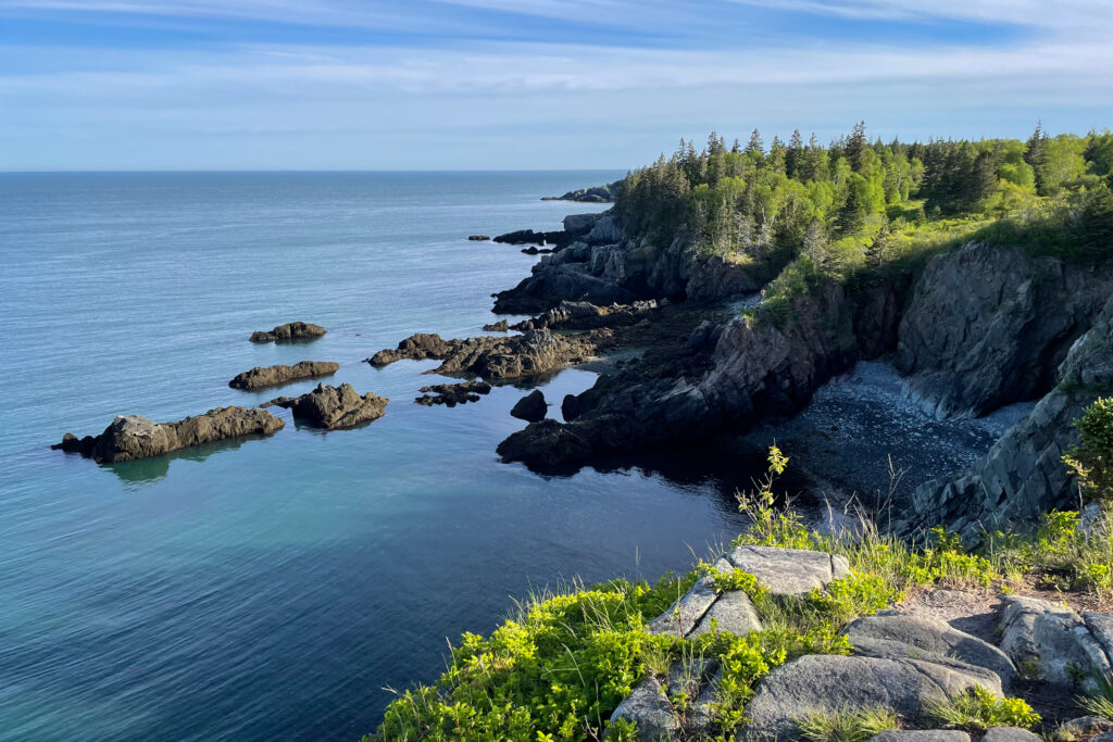
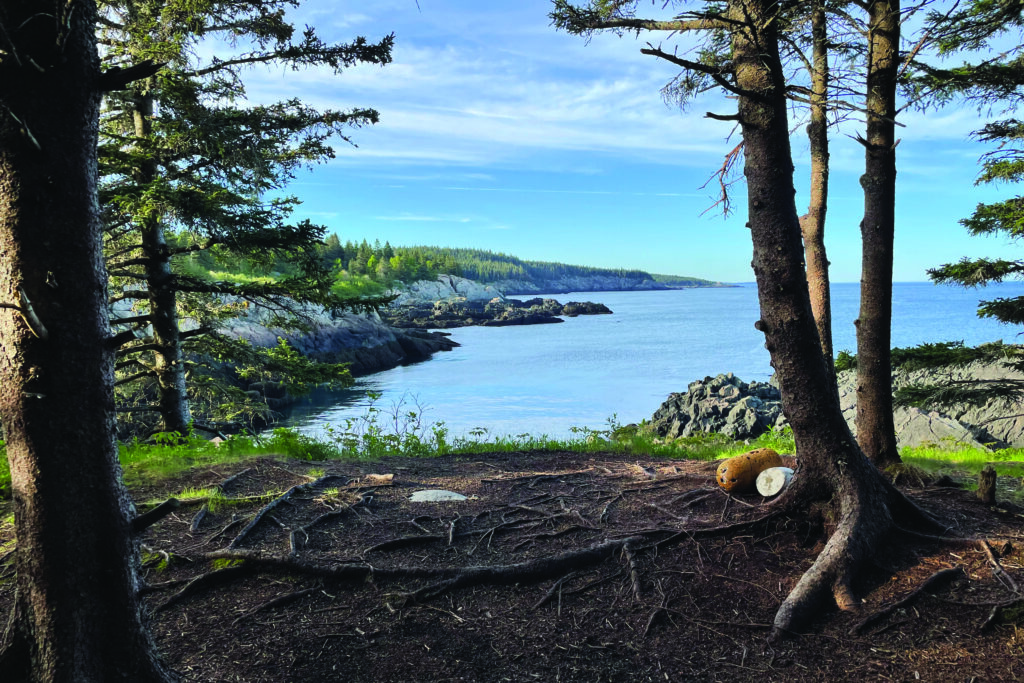
Cutler Coast Public Land
Located on the dramatic Bold Coast, this property covers 12,234 acres of blueberry barrens, woodlands, and peatlands, plus features 4.5 miles of ocean cliffs and cobble beaches. You can explore it on 10 miles of hiking trails, which lead to five backcountry tent sites right by the ocean.
Birdwatching is particularly good in this area, with nearly 200 species recorded. In addition, visitors often spot seals, porpoises, and whales swimming offshore.
Over the years, this has become an increasingly popular spot for people to experience the beauty of Down East. If you’d like to camp there, remember that the sites are first come, first serve. For a better chance of securing a spot, arrive early in the morning and, if possible, visit on a weekday or shoulder season.
Directions: In East Machias, turn right onto Route 191 and drive 16.9 miles (3 miles past Cutler village) to the trailhead and parking area.