Peaceful Ponds
Easy hikes and paddling adventures in Baxter State Park
Story & Photos By Aislinn Sarnacki
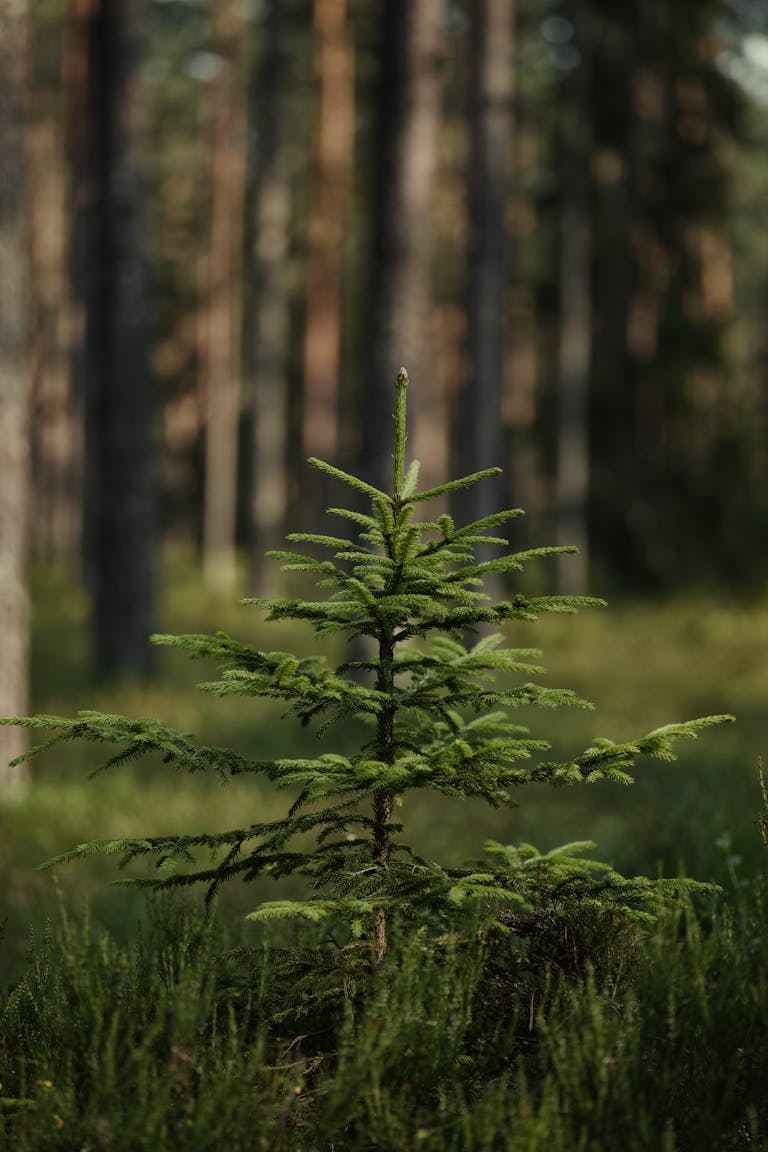
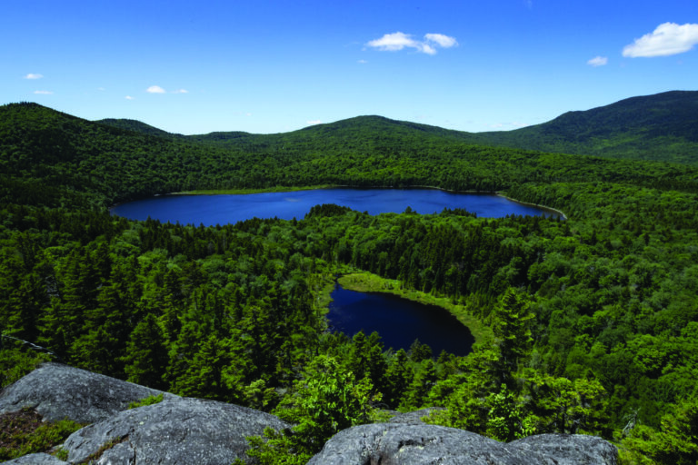
Home to many of Maine’s tallest mountains, Baxter State Park is known as a place to tackle challenging hikes, including the famous Katahdin. But that’s not the only way to explore the park. One of my favorite ways to enjoy Baxter is by visiting its many tranquil ponds.
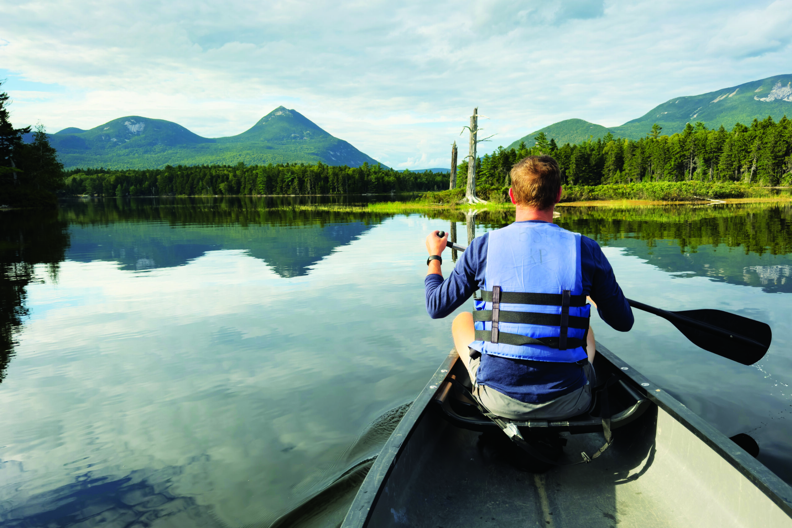
Within the 209,644-acre park, some ponds see more visitors than others. Kidney Pond and Daicey Pond, for instance, are each home to a rustic campground that you can drive to. At the campgrounds, you can rent canoes (and life vests) for the low price of $1 an hour or $8 a day, then take a leisurely paddle.
If looking for something a bit more remote, you can walk to a pond that’s only accessible by hiking trail. The park has plenty of those.
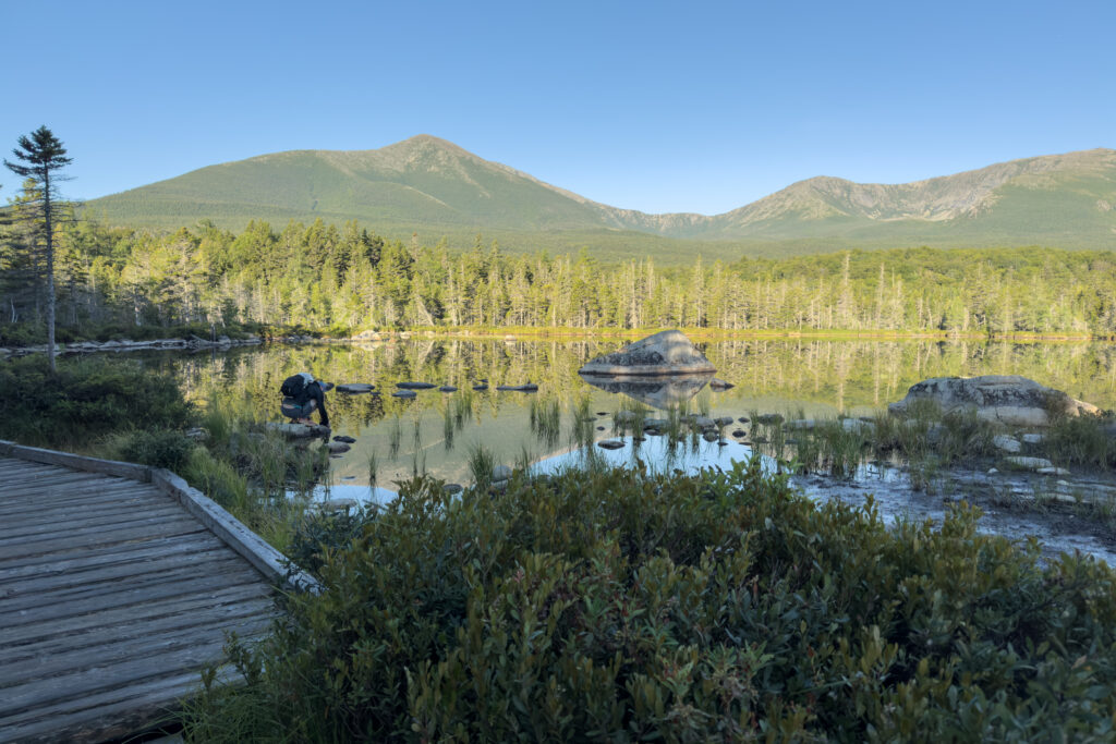
And, if looking for a bit more adventure, you can canoe on some of those walk-in ponds. You just have to plan ahead of time by visiting the nearest ranger station and renting the canoe that’s chained up on the shore of the pond. The ranger will hand you a paddle, life vests, and a key to unlock the canoe when you get there.
Yes, you’ll have to hike with a paddle in hand, but that will only fuel your sense of adventure.
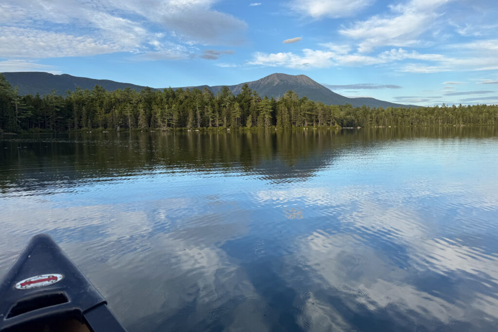
Ponds are excellent places to spot wildlife in Baxter. Commonly spotted animals include ducks, beavers, loons, and moose. Many of the ponds also offer fantastic views of nearby mountains. Plus, if the weather is calm, the still water will reflect the surrounding landscape for twice the beauty.
Here are a few ponds you can visit in Baxter State Park, though I highly suggest you purchase a detailed trail map for planning your adventure and navigating once in the park.
Daicey Pond
Easy
One of the park’s most popular destinations, Daicey Pond covers less than 40 acres, making it easy to explore by canoe. On its shore is a campground that includes 10 rustic cabins of various sizes, plus a ranger station and library. Canoe rentals are available.
The pond offers amazing views of Katahdin right from the shore, plus several hiking trails depart from the pond to visit nearby backcountry ponds including Lilypad Pond and Windy Pitch Pond. Both have a locked canoe that you can rent through the Daicey Pond ranger station.
Directions: From the south entrance of the park, veer left after Togue Pond Gate and drive 10.4 miles on the gravel Park Tote Road, then veer left onto the road leading to Daicey Pond Campground. Day use parking is in a small lot before reaching the campground at the shore.

Kidney Pond
Easy to moderate
Located just northwest of Daicey Pond on the Tote Road, Kidney Pond is notably larger at 96 acres. Its shore features 13 rental cabins of various sizes and designs, plus a ranger station, picnic area and library. Canoes are available to rent.
The pond offers a great view of Katahdin and Doubletop Mountain, but not from the shore of the campground. You need to paddle out onto the pond for the view to appear.
Kidney Pond Campground offers access to a number of easy to moderate hiking trails that travel through the forest to visit smaller ponds including Celia and Jackson ponds, Rocky Pond, and Draper Pond. All have locked canoes that you can rent through the Kidney Pond ranger station.
Directions: From the south entrance of the park, veer left after Togue Pond Gate and drive 11.5 miles on the gravel Park Tote Road, then turn left onto the road leading to Kidney Pond Campground. Be sure to park in the day-use parking area unless you’ve rented a cabin.
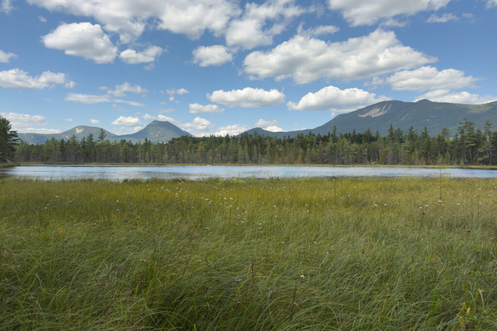
Sandy Stream Pond
Easy
This pond is particularly popular among wildlife photographers because it’s frequented by waterbirds and moose. On my most recent hike to the pond, I watched a white-tailed deer walking through the water, weaving between boulders, and I spotted a sandpiper wading along the shore.
The hike to the pond follows a fairly even and easy trail. You cannot canoe on Sandy Stream Pond, however, the trail travels along its scenic shore in a series of narrow wooden walkways, and there are a few places where you can stop, sit, and enjoy amazing views of Katahdin.
The trail leading to this pond also continues to South Turner Mountain, a wonderful, moderately challenging hike in the park. Topping off at 3,122 feet above sea level, it’s one of the smaller mountains in the park, but the top is steep and rocky. It’s a great option for people who are working their way up to larger mountains, or people who want to enjoy an epic mountain view without hiking all day long.
Directions: This hike begins at Roaring Brook Campground, which is one of the trailheads for hiking Katahdin, therefore you need to reserve a parking spot ahead of time. From the south entrance of the park, veer right after Togue Pond Gate and drive about 8 miles on the gravel Roaring Brook Road until you reach its end at Roaring Brook Campground. Be sure to park in the day-use parking area.
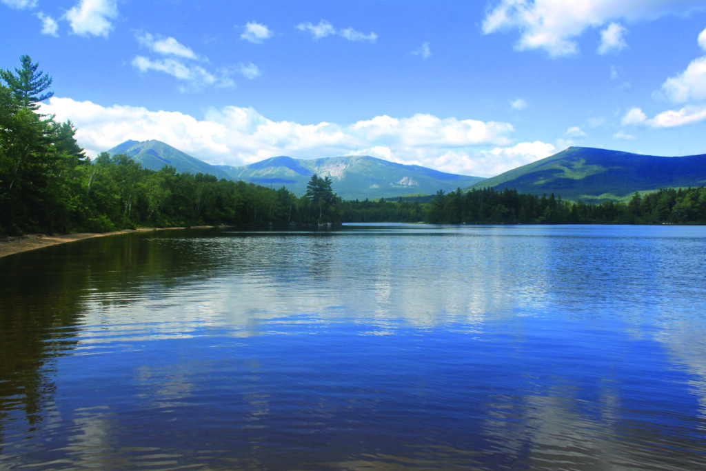
Katahdin Lake
Strenuous
If looking for a more challenging adventure to a beautiful body of water, I suggest the 6.4-mile, out-and-back hike to Katahdin Lake. The hike is relatively flat, traveling through a beautiful woodland area, but it does feel quite long.
Located on the east side of the park, Katahdin Lake is large, covering over 700 acres. Its shores offer breathtaking views of the mountains of the park, including Katahdin. In fact, these views have long inspired artists, ranging from 19th-century Hudson River School painters to contemporary artists.
The lake wasn’t always a part of Baxter State Park. It was added to the park with more than 4,500 acres in 2006 after a successful campaign to raise $14 million for the purchase.
Directions: The trailhead for Katahdin Lake Trail is at Avalanche Field. From the south entrance of the park, veer right after Togue Pond Gate, and drive 6.4 miles on Roaring Brook Road to the parking area.

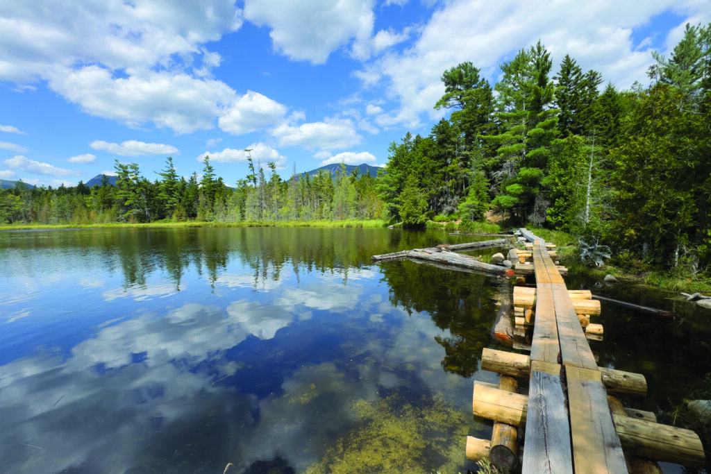
Grassy, Elbow, and Tracy ponds
Easy to moderate
If looking for a fun, easy hike to multiple ponds, this is a great option. Depending on where you start and how many ponds you choose to visit, the hike is between a quarter mile (if just visiting Tracy Pond) and just under 3 miles (if you hike a loop that includes all of the ponds, plus Daicey Pond).
This is a quiet, peaceful place to hike, traveling through mossy forestland that feels ancient. Locked rental canoes are available at the shore of Elbow Pond and Grassy Pond, but not Tracy Pond, which is quite small.
Directions: The park’s vast network of intersecting trails means you can start your hike from two locations: Daicey Pond Campground or a small parking area off the Park Tote Road just southeast of Daicey Pond Road.