Fall Foliage Frolics
Trails for enjoying the colorful forest
Story & Photos By Aislinn Sarnacki
It never gets old. Every year, starting in September, the Maine wilderness transforms as the green canopies become kaleidoscopes of yellow, red, and orange. Some leaves even display pops of peach, pink, and purple. Fall foliage is a sight to behold.
This colorful season also just happens to be an ideal time for hiking, with cool, comfortable temperatures and few bugs. (Though Maine is home to a species of mosquito that pesters people well into the fall — of course.)
Some hiking trails are better for viewing fall foliage than others. It depends on the makeup of the forest. If a trail threads through spruce-fir forest, common along the coast, you won’t be seeing many fall colors, just the ever-green needles of evergreens. On the other hand, if a path winds through a mixed deciduous forest of sugar maples, red oaks, big-tooth aspens, and white birches, you’re in for a treat. Those trees love to put on a show.
Over the years, I’ve found many colorful fall hikes, scattered through Maine. Here are just a few, ranging in difficulty from an easy boardwalk to remote and rugged mountains.
Jesup Path in Acadia National Park
Easy
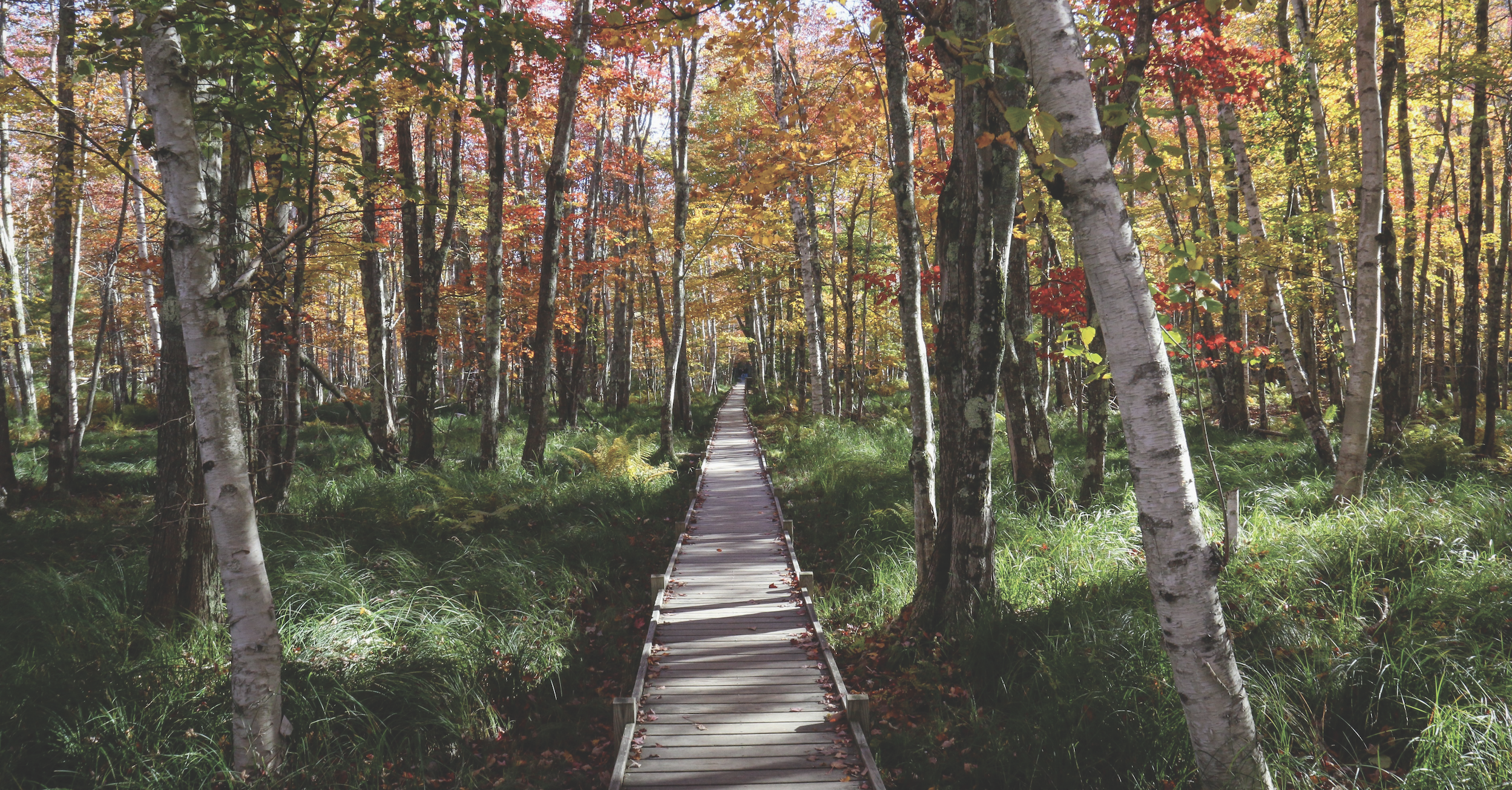
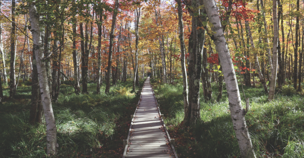
This long, wide, historic boardwalk travels through one of the prettiest forests for enjoying fall foliage in Acadia National Park. The forest consists mainly of white birch, which have leaves that turn bright yellow. A few maples scattered throughout add splashes of reds and oranges.
If you connect this trail with the Hemlock Path, it creates an easy loop that measures about 1.5 miles, perfect for families. This hike will also take you through a part of The Great Meadow, where you’ll find some bright maple trees.
If you’d like to extend your adventure, options abound, with connecting trails scaling the nearby Dorr Mountain and visiting a scenic pond called The Tairn. Also, right near the trailhead for this walk is the Wild Gardens of Acadia, a fenced-in area that contains meandering paths through carefully curated beds of native plants.
Dogs are permitted on this hike if kept on leash (no longer than 6 feet), however, they are not permitted in the Wild Gardens of Acadia. All visitors must display a park pass, which can be purchased online or at park visitor centers. A 7-day park pass for a passenger vehicle is $35. For more information, visit nps.gov/acad.
Directions: This hike begins at Sieur de Monts Spring Visitor Center, where the parking lot does fill up during peak times. The address is 2 Sieur de Monts Road in Bar Harbor.
Eagle Bluff in Clifton
Moderate
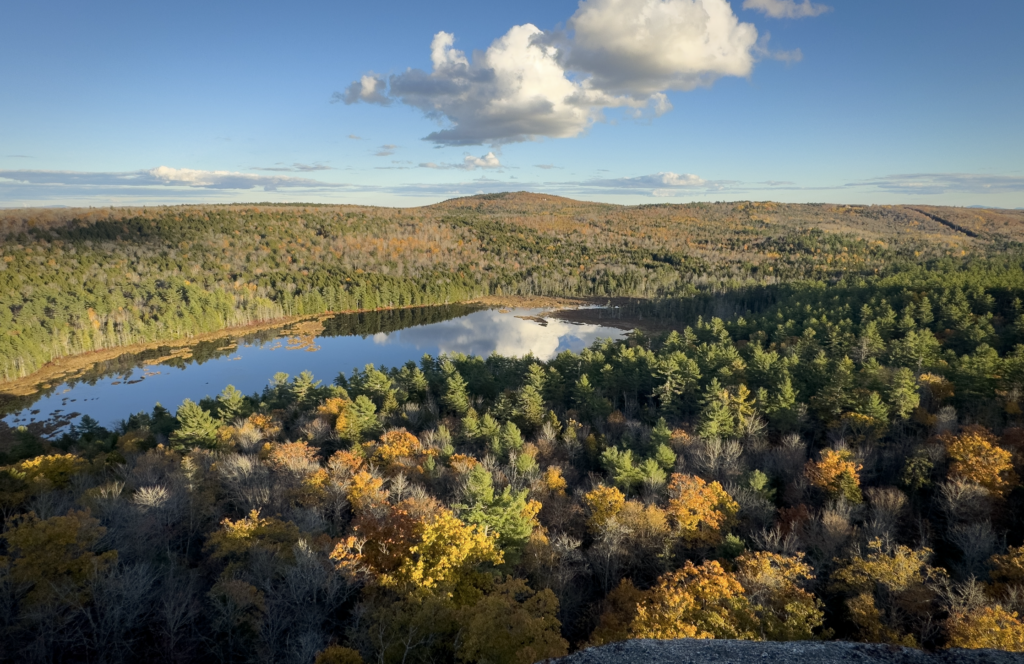
A little-known bluff not far from the busy streets of Bangor, Eagle Bluff is a destination for area rock climbers, but it also features a moderately challenging hike that leads to open views atop a dramatic cliff. The view includes nearby hills and Cedar Swamp Pond, which is surrounded by wetlands.
Wetlands can be especially beautiful in the fall because certain tree species that grow in wetlands, such as red and silver maples, display bright colors. In addition, the landscape viewed from the top of Eagle Bluff features plenty of mixed deciduous forest, where fall colors shine.
The Eagle Bluff trail network is maintained by the Clifton Climbers Alliance and is continually expanding. The trail that leads to the top of the bluff is a little less than half a mile long and is steep in a few areas.
Access is free. Dogs are permitted on leash or under voice command. For more information, visit cliftonclimbersalliance.org.
Directions: Parking for this hike is on Rebel Hill Road in Clifton. From the junction of Routes 9 and 180 in Clifton, drive 2.5 miles down 180. The small parking area for the trailhead will be on the left.
Trout Mountain near Millinocket
Moderate to Challenging
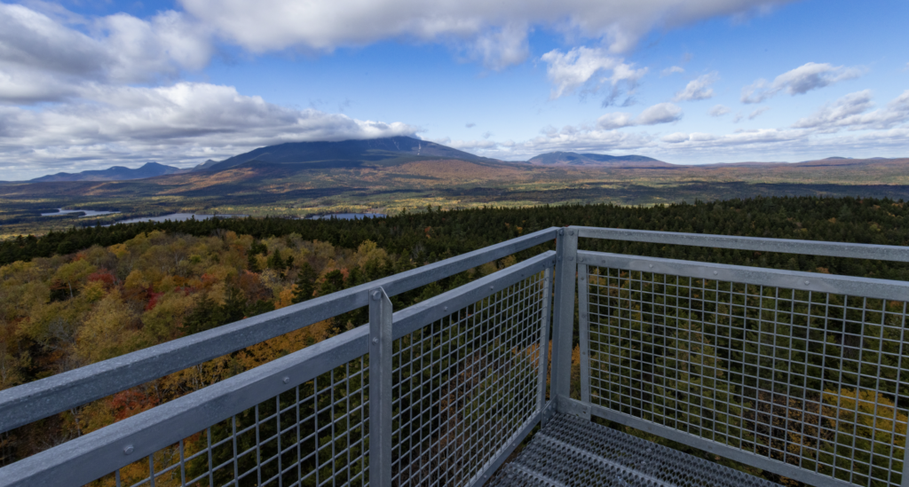
Trout Mountain is topped off by an 80-foot-tall observation tower that offers an unobstructed 360-degree view of the Katahdin Area, including a stunning view of Katahdin itself. If looking to take in the fall foliage of that region, you’d be hard pressed to find a better spot.
Rising 1,409-feet above sea level, the mountain offers a moderately challenging hike over rugged terrain. The trail to the summit measures 2.7 miles, making for an out-and-back hike of just over 5 miles, most of which is gradual.
The hike is located within the 3,598-acre Trout Mountain Preserve, which is managed by The Nature Conservancy as an ecological reserve where natural processes such as ice, drought, and wind shape the forest — not logging.
Access is free. Dogs are not permitted. For more information, visit nature.org.
Directions: The parking area for the preserve is located on Baxter Park Road, about a mile south of the Togue Pond Gatehouse of Baxter State Park. This is about 16 miles from downtown Millinocket if heading toward Baxter State Park.
Tunk Mountain near Sullivan
Moderate to challenging
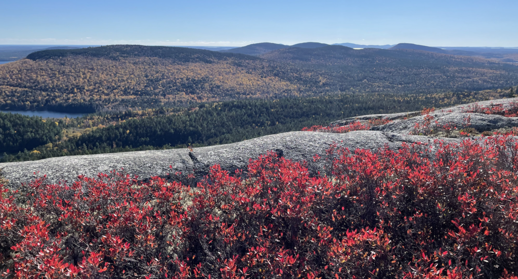
Rising 1,157 feet above sea level, Tunk Mountain is one of the tallest peaks in eastern Maine. A fairly popular hiking trail explores the mossy forest and pristine ponds at the foot of the mountain, then leads up to open ledges near its summit.
The majority of the forest on this hike is evergreen, so why is it a good fall foliage hike? The views from ledges near the top offer unobstructed views of the fiery foliage blanketing the landscape for miles around.
The 1.8-mile Tunk Mountain Trail features several steep sections, including a spot where hikers must climb up using three iron rungs embedded into the rock.
This hike is located on Donnell Pond Public Lands, 14,000 acres of state-owned land in Hancock County. This sprawling parcel of conserved land is home to several mountains, ponds and lakes. Access is free. Dogs are permitted if on leash or under voice control. For more information, visit maine.gov/dacf/parks.
Directions: The parking lot is off Route 182, also known as Blackwoods Scenic Byway or Blackwoods Road, between the towns of Franklin and Cherryfield. If driving from the west, the trailhead parking is just under 1 mile from Fox Pond. If driving from the east, it’s just over 2 miles from the Tunk Lake boat launch.
Number Five Mountain near Jackman
Challenging
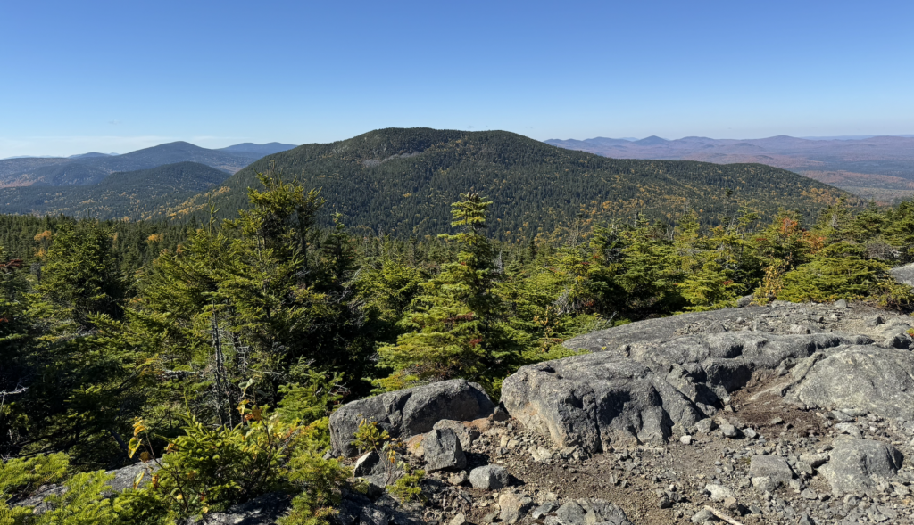
Located in the 16,934-acre Leuthold Forest Preserve, Number 5 Mountain tops off at 3,156 feet, making it a high peak by Maine standards. The trail leading to the summit measures about 2.7 miles long and travels through a leafy forest that’s perfect for viewing fall foliage. It’s an out-and-back hike, so plan for a round trip that totals over 5 miles.
This hike strikes through an alpine forest that’s filled with heart-leaved birch trees, also known as mountain birch. The heart-shaped leaves of these trees turn golden yellow in the fall.
This area of Maine is home to some northern wildlife species that you won’t find in southern parts of the state, including boreal chickadees. They’re similar to the abundant black-capped chickadee (Maine’s state bird), but have rich brown feathers covering their head and parts of their body. They also have a raspier call.
At the summit of the mountain, you’ll find an old steel fire tower that’s closed because the structure is no longer safe to climb. You’ll also find open views that include Number 5 Bog, Attean Pond and the nearby Number 6 Mountain.
Access is free. Dogs are not permitted. For more information, visit nature.org.
Directions: Primary access to the preserve is from Spencer Road, which is off of Route 201, south of Jackman, across from the Parlin Pond boat launch. Follow Spencer Road approximately 17 miles west from Route 201 to an unnamed road on the right. Follow this road for 0.5 mile to the parking area at the end.